Featured Photo: Big Laurel Falls

Featured Photo: Big Laurel Falls

Saturday, December 02, 2023

Colorado 2022: Day Thirteen, Fishing One Last Nice Day and Battling Rodents

While the overall Colorado trip was great, the end was definitely a slog. This was because the weather turned sour for an extended amount of time. I had made the mistake of bragging to my wife about how, while it might rain, it would be nice a few hours later and definitely no later than the next day. This set us up for the obvious result: days and days of dreary weather that was increasingly colder by the day. And yes, I'm still reminded about how much fun that part of the trip was. Deservedly I might add...

When we woke up, it was fairly chilly. That was to be expected. The canyon we were camping in was sheltered by high walls to the east and west. That meant the sun wouldn't hit the campsite until at least 9:30 or 10 in the morning. With the late season, we were already pushing our luck by camping, so we hoped it wouldn't snow. After sleeping late to stay warm, we finally got up and fixed breakfast. While Leah and Little Bit were busy in camp, I grabbed a rod and fished just a few steps away. The camp pool had been kind to me before, and I was hoping that might be the case now. Sure enough, a couple of good brown trout were ready to play. Nothing huge, but it got me excited by the prospects. 

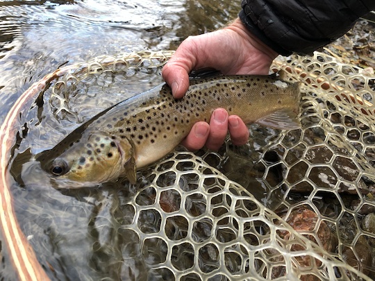
Lake Fork Gunnison Brown trout at Gateview Campground


Lake run fish ascend this system from the large reservoir below. Kokanee and large brown trout move up in the fall. I was hoping for both. Unfortunately, there were no signs of the salmon, and we saw very few brown trout over the next couple of days. I'll have to return another time to try again. What we did find were rainbow trout and plenty of them. 

After breakfast, we all got ready and wandered down the trail to fish. Naturally, the day progressed as one would expect. Leah caught the big fish and Little Bit got bored quickly. That meant back to camp to play and enjoy what would feel like our last glimpses of sunlight for the trip. 

Lake Fork Gunnison rainbow trout at Gateview Campground


As the sun dropped below the canyon walls for the day, the temperature started dropping quickly. We bundled back up, and I hit the camp pool once more. One more brown trout came to hand. While I expected to find fresh fish in this pool every day, that wasn't meant to be. This would be the last fish I would find in the camp pool, although we would find more fish downstream on future days. 

Late Day on the Lake Fork of the Gunnison at Gateview Campground


lake fork gunnison streamer eating brown trout


As the shadows lengthened, we started getting supper ready. Unfortunately, it didn't take long for the scope of our problems became abundantly clear. I had never had problems with mice at this campsite, but it had become obvious the night before that at least a couple of the critters were around. Not to worry, I had come prepared with lots of sticky glue traps. I had deployed them effectively around and throughout our car. When I had found two that morning, I had hoped the problem was solved. Apparently I just made them all mad. 

It got darker and darker. While we were eating supper, mice were running around everywhere. It appeared that this campground shared the fate of some of my other favorites in Colorado. I'm unclear on how these things get around, probably in people's cars. The fact remains that they are almost EVERYWHERE in Colorado now. I've had big time problems in Elevenmile Canyon and the Black Canyon. Now I can add Gateview to the list of campgrounds I'm paranoid of staying at.

The worst part about the mice (other than the fact they absolutely destroyed our car every night in all ways imaginable) was having a toddler along. In an environment that already wasn't super sanitary, trying to keep Little Bit safe from rodent borne disease suddenly became priority number one. Leah was less than thrilled about the whole deal. I deployed more sticky traps, hoping for the best. As we crawled into our tent for the night, mice were running all over. I knew we already had some in the car. I had seen them through the rear windshield. Not knowing what else to do, I finally crawled into the tent. It was too late in the day to pack up and start home, so we would spend another night and hope for the best. We had plans to stay two more nights, so time would tell how that would work out. 

Tuesday, November 28, 2023

Colorado 2022: Day 12, Moving Day Again

While we didn't know it yet, our trip was seriously starting to wind down. There were still some great moments, but things were headed in a negative direction. First and foremost, the Crystal Mill hike was going to be hard to beat no matter what. Unfortunately, one of our group was set on trying to beat the happenings from the morning of that big hike, as you'll begin to find out in a moment. Even further, we woke up to yet another round of rain, and the weather wasn't going to get any better until it was time to go home. 

We were still optimistic, however, as we broke camp at Bogan Flats Campground and headed out to enjoy another day of fall colors we hoped. Our goal for that evening was to find a camping place within an hour or so of Gunnison. That is one of my favorite areas of Colorado, and I had high hopes to finish the trip doing a little fishing on the Gunnison and some of its tributaries. To get there, we planned to drive over one of my favorites, Kebler Pass.

We made the quick jump over McClure Pass from the Crystal River Valley, and were soon approaching the turn onto County Road 12. This unassuming gravel road winding back through the hills towards Crested Butte features some of the most stunning fall scenery I've seen in Colorado. When the aspen are at their peak, this drive is very hard to beat. We were just a week or ten days early on our trip, at least for the best colors. However, as you'll see, we still saw some very nice golden aspen.

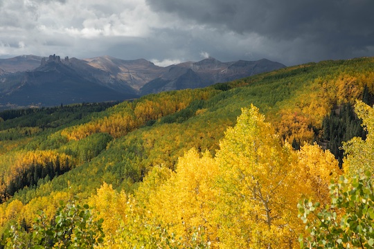
Golden aspen fall colors Colorado


Not far along County Road 12, a now familiar stench hit us. Looking at my wife with concern, I asked if we should pull over. "We probably better," was her reply. Sure enough, we had our second blowout in two days. This was a full mess requiring professional help and cleaning. We cleaned up as best we could, then continued on our way. The nearest laundry facilities were far off and we had a long ways to go.

The clouds were mesmerizing, looking like it was about to storm at times, with the sun trying to come out at others. Against the dramatic sky backdrop, the fall colors were special even if not at peak. 

Golden aspen near Kebler Pass


Driving along our route, I remembered another road that I had enjoyed in the past. We turned off on County Road 730 to enjoy Ohio Pass. Unfortunately, we were now in too much of a hurry for another favorite along this route. The short hike up to the beaver ponds just south of Ohio Pass can net some gorgeous brook trout, not to mention a hike through a phenomenal aspen forest. On this day, we were already short on time with the need for an unplanned pit stop ahead, so we kept pushing on. The brook trout would have to wait until another trip. 

Golden Aspen near Ohio Pass


It was probably somewhere on this drive that we started to realize that our trip was winding down even if none of us admitted it or voiced it. There were too many things starting to conspire against us. If we had been smart, we would have called it a trip and headed home right then and there, but we still had almost a week of adventuring left and persisted in our plans.

As we hit the lowlands, I pushed the little car harder to get into Gunnison as fast as possible. Leah started searching for laundromats on Google maps. Thankfully, we found something quickly. I grabbed everything that had been soiled yet again and raced in for a quick cleaning. An hour later, we were debating whether to grab food in town or race on out to camp before dark. 

The pull of one of our favorite Italian restaurants was too much, so we stopped at Mario's Pizza and Pasta in Gunnison. Little Bit was really starting to enjoy the concept of eating out, and the waitresses all loved her to death. We enjoyed a hot meal in a warm dry place, and then hit the road in the gathering shadows. 

Our goal was the Gateview Campground. I had experienced some incredible fishing there many years before. Even better, I had the tiny campground to myself. I was hoping to replicate that great time with my family. Unfortunately, yet another complication was about to rear its head, but at the time, we were tired and just wanted to get to camp. 

Sunday, November 26, 2023

Fishing Around the Brown Trout Spawn

There are tons of opinions on whether you should be fishing during the spawn. Some states solve the problem by having closed seasons for trout fishing. Many other states do not, leaving anglers to come to terms with their own set of ethics. Here in Tennessee and in the Great Smoky Mountains, we are fortunate to be able to fish year round. That helps keep the cabin fever at bay during the cold months, but also makes it important to figure out your own set of ethics when it comes to fishing or not fishing the spawn and the time periods around it. 

Often, it seems irrelevant as to whether it is "okay" to fish during the spawn or not, but a variety of factors the last few years has led to a huge decrease in the number of large trout on many area waters. From the Clinch River wild rainbows and big brown trout, to the big browns on the Caney Fork, to the wild browns in the Great Smoky Mountains, numbers of larger fish are down across the board. While the overall reasons behind that decrease may or may not be angler driven, the fact remains that we have lower numbers of fish. Thus, it is more important than ever that the fish be allowed to procreate in peace. That is the place I'm at. You may arrive at something different. That is okay, but if you want to do what's best for the fish, read on. 

Choosing to fish (or even guide) around the spawn immediately brings a new set of challenges. How do you fish water that fish are spawning in without interrupting that process? To some extent, interruptions will happen no matter how careful you are. In my opinion, other than not fishing to actively spawning fish, the most important thing you can do is to watch your step. The precious eggs, once distributed into the gravel, are vulnerable to a misstep. In fact, just once misstep could kill nearly all the eggs in one redd. Thus, you now have a couple of options. Either avoid fishing and wading altogether during the spawn, OR learn what to look for and avoid redds at all costs. 

If you choose the latter, here is what you should look for. Brown trout redds are usually depressions and accompanying mounds in the gravel in riffles and tailouts of pools. I've seen redds in all kinds of water, but most will be in the riffles and tailouts. However, the most important thing is gravel. On some streams, good spawnable (did I make up a word?!?!) gravel is hard to find. It appears easiest to learn what kind of gravel is good for spawning and simply avoid walking on all gravel that is similar. In actual practice, it is helpful to be able to identify redds and walk on gravel when possible, because gravel is often going to be your best traction in the stream.

To understand what a redd looks like, first you should understand how the redd is built. First, the female finds the perfect site for her nest. Next, she begins to fan with her tail to dig out a depression. That depression is where she will lay her eggs. Once she has prepared the nest, she lays some or all of her eggs while a dominant male delivers milt to fertilize the eggs. Then, she will move just upstream and stir the gravel again, allowing the current to filter the gravel down onto the eggs to protect them. This small mound that forms is where the actual eggs are stored. Some fish may repeat this procedure several times leaving an area well stirred up, while others may make a single redd and call it quits. This process applies to rainbows and brook trout as well. Once those eggs are laid in the gravel, it is crucial for anglers to avoid stepping on the nests. Each generation will often see a fairly low success rate, so we need every nest to stay viable if possible. 

The incubation periods can vary wildly depending on water temperatures. Long periods of 4-5 months at a constant 35 degrees Fahrenheit down to a very short 30 days at 57 degrees Fahrenheit mean that it depends on the weather and stream as to how long it takes for the eggs to hatch. In the Smokies, most of our eggs will typically hatch sometime in January into February in a normal year and depending on exactly when they were laid. For fish that spawn in late October or early November, it is possible that same hatch by early January, while late spawning fish in late November into December may not have eggs hatching until closer to March. 

Other than anglers, extreme cold and anchor ice can disrupt the viability of the spawn. Extreme flow events with high water can also disrupt the process. Finally, on our tailwaters, low dissolved oxygen is also a major limiting factor to successful brown trout spawning. 

If you have read this far, then you clearly care deeply about the health of our wild fisheries. While everyone needs to make their own decisions as to whether to fish the spawn or not, I hope you will at least be very careful as to where you walk during the fall through spring period. The health of our fisheries depends on anglers being careful. Here are several examples of brown trout redds in the Smokies from the past few weeks. Note how redds often appear as bright patches in an otherwise darker bottom. 


brown trout redd

brown trout nest

wide stream view including redds

closeup of brown trout redd

One last redd

If you have any questions or want some better pictures, feel free to contact me using the information from the contact link above. I'm always glad to help promote the health of our fisheries. 

Saturday, October 14, 2023

Colorado 2022: Day 11, Hiking from Marble to Crystal Mill

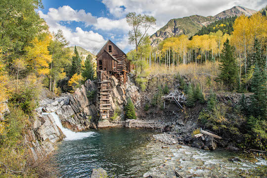
When I was a youngster just learning to fly fish, I subscribed to Fly Fisherman magazine. An article one month was on the Roaring Fork valley in Colorado. While I don't remember many of the details of the article, one thing has always stayed with me: a picture of the Crystal Mill near Marble, Colorado that was included in the article. Mind you, it wasn't labeled as such. It was just a scenic piece to add interest to the article otherwise convincing anglers to head for the Fork or Frying Pan to fish at all costs. At the time, I didn't know exactly where it was, just that I wanted to see that scene someday. 

Fast forward just a few years, and I eventually discovered the location of the scene that had stuck with me for so many years. When we started planning a trip to Colorado for last fall, I determined that we had to visit the Crystal Mill. There are lots of places I want to visit, and I don't know how many more Colorado trips will happen. There are other places to go and see after all. So, I wanted to hit the one thing in the state that was still on my must see list, or dare I even say, my bucket list. My bucket list, if you want to call it that, is a loose collection of places I want to see someday. Nothing written on paper, and some are more definitive than others, but I'm to the point where I'm trying to check a few off of the list nowadays.

After we had travelled from State Forest State Park to Dillon and then on towards Bogan Flats Campground, we were ready to get back into the woods. Our town stay had been a nice reprieve, but we didn't travel all the way to Colorado to stay in a hotel in town.

Unfortunately, before we could enjoy a trek to the Crystal Mill which was just up the road from our campground, we had to take a detour. We didn't know it at the time, but a distinct trend had started in more ways than one. The first trend actually started during the night. Light rain showers whispered on top of our tent. When we got up in the morning, the clouds were breaking some, but we also didn't want to get caught in a storm or downpour while out hiking with a toddler. 

Camping at Bogan Flats near Marble Colorado


Cell service was at least a few miles back down the road towards Carbondale, so we decided to head that direction and get an updated weather report before venturing out for the day. This was both a good and bad decision. Good because, well, things were about to happen that I REALLY didn't want to happen in the kid carrier pack. Bad because, well, it should be self explanatory. 

Little Bit was riding along comfortably in the back when it apparently became time to do her morning business. We were almost to cell service when the aroma stench hit us. I pulled over into a large gravel pullout that would double as a bathroom/changing room and also had enough cell signal to help us in other ways. As it turns out, we needed that cell signal for directions to the nearest laundromat. Things had gotten out of control, so to speak, and we needed more cleanup ability than we could carry in our little car. 

At the sketchy little laundromat, I did laundry next to a homeless guy while Leah made some bagels and cream cheese for our breakfast. After an hour of doing laundry, we were headed back towards camp and then on to Marble, hoping that this would be a one time event and the rest of our trip would go smoothly. The forecast looked to turn a little more rainy over the next few days, but still suggested a good mix of sun and clouds. The forecast for our hike that day was mostly good with just a small chance of a shower. 

We found Marble and a parking area where we could leave the car for a few hours. The road up to the historic Crystal Mill was a rough 4WD road that our little Corolla wouldn't even begin to negotiate. Unfortunately the jeep tours that operate in the area have a strict "no car seats" policy that effectively weeds out younger kids. I don't blame them, but I will say that it would have been a much easier day for us. 

Beaver Lake near Marble


We loaded Little Bit up in her pack and began the grueling hike up to the Crystal Mill. It is only about 4.5 miles or so, but the first mile was brutal with probably 1000 feet of vertical gain. The rest of the hike was actually fairly easy other than the 30 pounds or so in the pack on my back. At the time we visited, you could pay a little money and then access the bottom of the falls. From things I have read, I believe that is sadly no longer an option. 

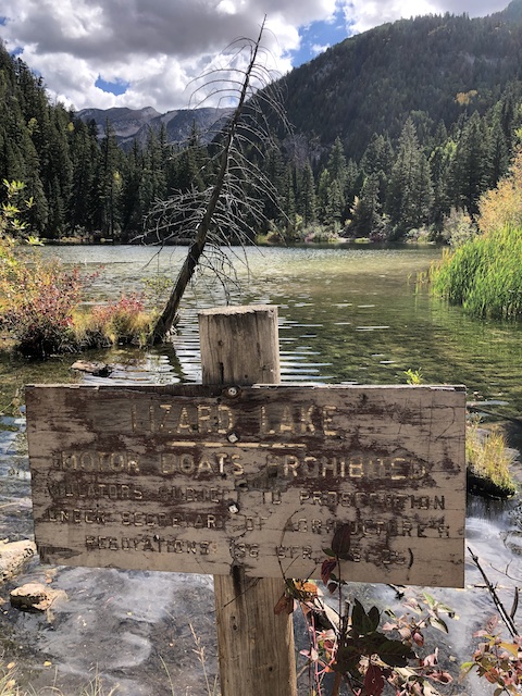
The trail/road is fairly busy or at least was when we visited. Lots of jeeps and trucks were driving up to see the same place we were as well as some others scenic places in the area. Thankfully, they were all considerate and we never felt in danger despite the road being quite narrow at times. We got tired quickly, some of us more so than others. Little Bit was needing a snack, so we stopped by Lizard Lake for a quick break and some snacks.

Lizard Lake on the Road to Crystal Mill


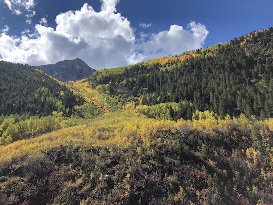
The timing of our trip was largely in hopes of catching the fall colors. Sections of our hike were about perfect with golden aspen everywhere, while other sections still had mostly green. With the nice mix of color, the hike was interesting throughout. One of the most interesting things, I thought, was the constant avalanche chutes and debris fans from past avalanches. The ridge to the south, just across the Crystal River (which the road/trail follows) apparently gets a LOT of big snow in the winter. The avalanches then roar down the north facing slope and often up and across the road on the other side. I can only imagine how treacherous this area would be in the winter. 

Avalanche chute full of fall colors on the road to Crystal Mill

The Crystal River itself was beautiful and truly crystal clear as its name suggested. I kept wishing that I had brought at least a tenkara rod with me, but because we started the hike late, I had left all fishing gear in the car. We didn't have as much time as we wanted, but thankfully our timing was perfect from one perspective. Once we made it up to the Crystal Mill, it quickly became apparent that afternoon was the best time to visit this scene, at least in late September and early October. 

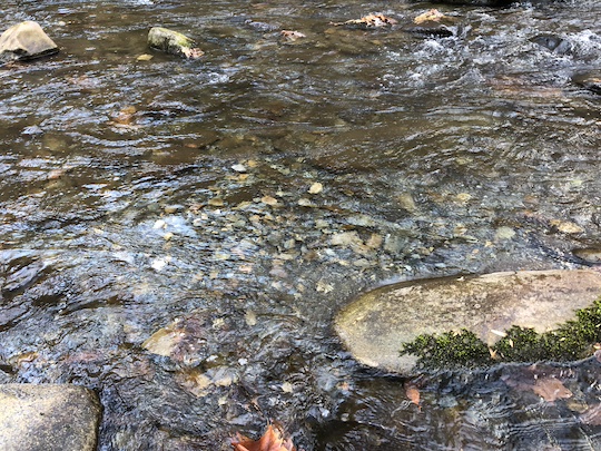
Crystal River along the road to Crystal Mill

The early autumn light was angling in just right to light the scene for our cameras. We took more photos on this day than any other on our trip. Since we were able to go to the bottom of the falls, we had our picnic lunch down there. Little Bit played amongst the rocks along the stream (one of her favorite things to do!) while we took pictures of her having a good time.

Crystal Mill on Crystal River

View of Crystal Mill


Eventually, we knew that it was time to head back down. Carrying a heavy pack was starting to wear me out after more than a week of camping. While the hike out was mostly downhill, I still wanted to get it over with. On our way out, we experienced a very light shower that was perfectly brief. We put up the rain cover on the kid carrier, but otherwise didn't worry about the rain. If only the rain showers had stayed that brief for the rest of our trip...

Fall colors on the road to Crystal Mill


Sunday, October 01, 2023

Colorado 2022: Day Nine and Ten, Moving Days

Not every day of a big trip can be exciting. Thus it was that we found ourselves transitioning from northern Colorado to more central and southern portions of the state. On trips as long as this one, we tend to try and mix in a laundry day. Little did we know what still lay ahead in that regard, but at the time we just enjoyed the chance to get into town, get showers, stay at a hotel, and let someone else cook our food for a couple of meals. 

From State Forest State Park, we travelled down to Dillon which was part of the way towards our next destination. Without the toddler, I would have been tempted to make it through a town day and all the way to our next campsite in one day, but we had already discovered that trips were slower with her along. It was best to spend the night in a hotel and then travel the rest of the way on the second day. 

Doing it that way, we hoped to possibly even get an extra hike in. The route from Dillon that we wanted to follow included Independence Pass and down through Aspen. The fall colors were the main motivation for this route choice, but it also was close to the most direct route. Our next camping spot was at Bogan Flats near Marble, Colorado. I wanted to hike to the Crystal Mill, so this was the closest campground option as it was just down the road from Marble. 

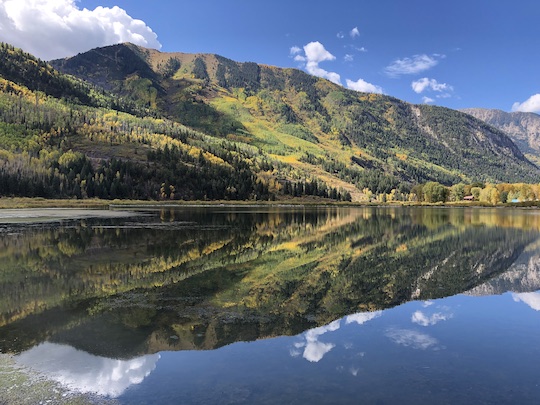
Independence Pass is always a treat. We hoped to do a hike from near the top of the pass to some high elevation lakes. On our way up, we stopped at Twin Lakes and took in the beauty of the fall colors reflecting in the water. The dramatic scene was incredible for pictures, but a bit foreboding and foreshadowed the weather we would find on top of the pass. We wouldn't be hiking on this day as it turned out.


This ended up being the highlight of our 10th day in Colorado. While the scenery was incredible the rest of this day, the fall colors weren't quite as far progressed as we had hoped. We enjoyed driving down through Aspen and were soon headed south towards Bogan Flats on the banks of the Crystal River. The next day would be a big hiking day, and we needed to get rested up for the adventure. Little did we know what was in store for the next few days...


Thursday, August 03, 2023

At Long Last, the Water Control Manual Update for Center Hill Dam

Almost a year late but better late than never, the proposed water control manual (WCM) update is here from the Corps of Engineers. Find out more HERE. In short, it looks like they will continue the pattern they have been running (one hour of generation every 8 hours) to provide a minimum flow on the Caney Fork River. 

Unfortunately, as of right now, they are not going to provide a continuous minimum flow which would work wonders for this river. 2016, our last significant drought year, had a continuous minimum flow of 250 cfs and the trout population was better than it has been since the leaks in the dam were mitigated. Things quickly went downhill after that as they returned to long periods of dewatering the riverbed. 

At the link above, find a link to the proposed updated manual along with instructions on how to comment if you have something to say about it. In addition, the Corps of Engineers will be hosting a public meeting to update the WCM. If you're at all interested, below are my thoughts that I emailed to the Corps of Engineers. 


Hello,

I am writing to give my feedback on the water control manual (WCM) update proposal.

First, I would like to say that the preferred alternative of one unit every 8 hours is a vast improvement over the prior WCM. However, it unfortunately does not address the portion of the river that most needs a minimum flow. In your document, you acknowledge that the majority of fishing pressure is focused on the upper 5 miles of river. However, the preferred alternative regularly dewaters too much of the streambed in this section.

I would strongly urge you to consider alternative 10 which features one unit every 8 hours along with a 250 cfs continuous minimum flow. I'm not sure how you came to a value/ranking of "2" for the recreation category on alternative 10, but that doesn't really fit your own criteria. In fact, under the recreation category, alternative 10 should receive a rating of "4" due to frequent safe conditions for wading and swimming (I don't know if anyone swimming in the Caney and haven't seen this happening myself) AND even more importantly, it would "provide enough flow to support recreational boating and fishing at most locations downstream of Center Hill Dam."
During 2007-2010, I regularly waded at Happy Hollow and while some sections of riverbed are less accessible at these higher flows, the fish thrive and spread out to become more accessible with less wading. In fact, I caught one of my all time best fish on the Caney Fork ever, a brown trout, at Happy Hollow during this time period. The fish was sitting and feeding on a section of gravel bar that is now regularly completely dewatered. Fish were regularly feeding along the edges where they were very accessible. Now, they look for the little deep water they can find and concentrate into those spots. This requires MORE wading, even though flows are lower. In fact, back in 2007-2010, I would walk the gravel edges at Happy Hollow and catch fish in water that was a foot or two deep. Now, those fish are nowhere close to those locations. During higher flow times before the dam repairs, I could regularly find many large brown trout in very accessible locations, because the extra water in the streambed provided the habitat for those fish to live in shallower water. Now, they are left with only a few deep holes as their only retreat.

Lower flows are harder on fish because they are more easily located, meaning that harvest rates increase. These fish do not have any sanctuary in the upper river at these very low flows, meaning holdover fish (larger trout) have a harder time surviving. Unless stocking rates are going to significantly rise, fish need more opportunity for sanctuary. I've seen anglers wading sections of river FAR from any access point and harvesting large numbers of trout. This is because they are able to walk up or down the river to get there, often from a mile or more away. At slightly higher flows, this process is more difficult and gives the fish more chances to grow. Water management is important to fisheries management, and the Caney Fork can produce many more quality fish than it currently is. However, the fish must be given a chance to stay in the river for this outcome to happen.

Because the upper Caney Fork receives the most fishing pressure, I would suggest a continuous minimum flow to provide better habitat and conditions for the resident trout. I will add that the one hour of generation every 8 hours has done wonders for the middle to lower river and should be maintained as such. Because there is a distinct lack of wade access in this lower section, these flows strongly favor anglers with boats instead of wade anglers. While I have a boat and this doesn't directly impact me as much, it will be better for the entire river if we get a continuous minimum flow to not only keep the trout healthy, but also to spread out users on the upper river and reduce conflict between user groups. At current low minimum flows, I have to get out of my drift boat and drag it over several gravel shoals between the dam and Happy Hollow. This can easily be fixed with a continuous minimum flow and benefit the trout and macroinvertebrates they rely on in the process.

One thing I am interested in is a smaller minimum flow of 150-200 cfs. It has the potential to provide a better outcome for upper river fish and recreational users AND improve the amount of potential generation capacity from the 250 cfs constant minimum flow. I noticed that you eliminated the lower constant minimum flow alternative due to cost, but it was never actually stated what the cost would be to modify the existing orifice gate. Do you have those numbers? Or did I just miss it somewhere? I'm wondering if that is something that TU or some other organizations could get involved with in terms of fundraising. Are we talking thousands of dollars or millions?

Finally, I am disappointed that more is not being done to address dissolved oxygen (DO) issues. We are already seeing the results with stressed fish on the upper river over the last week. The big rain event a couple of weeks ago that necessitated higher releases has significantly impacted DO numbers and the fish have been showing the resulting stress. Has there been any discussion to run liquid oxygen into the forebay? I know this is done on TVA dams like Norris in the fall as necessary and has worked very well in mitigating dissolved oxygen issues. If not oxygenating the forebay, then how about mandating the use of the sluice as soon as DO readings start to drop below state mandated water quality standards? I would prefer that instead of just leaving it up to the discretion of the operators, since this can vary widely from one operator to the next.

In short, we need more done to help with both the trout, their food sources (macroinvertebrates), and recreational users of the river with more water and better water quality.

Thank you for considering my comments.

Sincerely,

David Knapp

Wednesday, July 26, 2023

Colorado 2022 Day 8: Moose, Fall Colors, and Hiking and Fishing Lake Agnes in State Forest State Park

After a moving day, we were ready to get out and move again. Our best rewards on these trips involve medium to long hikes, not to mention that we had a toddler along that wants nothing more than to keep moving. Long days in the car wear on all of us accordingly. After a night spent listening to the camp deer munching shrubbery just outside the tent, we were up and ready for adventure. 

Because of the issues with water, we developed a new routine for our two nights at State Forest State Park. Mornings were chilly enough, that it was nice to get up and head straight for the vehicle. Cranking the heat a little got us all warmed up and ready for the day. Our goal was to do a short drive while it was cold, then stop for breakfast at a different campground that had water. Thankfully, it had very few people in it, so we could just pick a table and set up for breakfast. Nobody ever bothered us either, and while I know most places are funny about you picnicking in campgrounds, I was annoyed enough that I didn't care. 

Moose in State Forest State Park

Our goal that morning was to find some moose. That is always high on my agenda on trips to Colorado. On this trip, it didn't take long. We were still creeping along the rough gravel road away from camp when we spotted a cow and half grown calf. Lighting wasn't great, so after a few half hearted attempts at pictures, we kept going. That proved to be the right decision. Shortly after getting on the main road and heading further down the mountain, we found a magnificent bull moose foraging in the early morning glow.


Bull moose in State Forest State Park


Fall Colors, Scenery, and Wildlife at State Forest State Park

After spending a decent amount of time with him via our cameras, we headed on down the hill to drive into a part of State Forest State Park that I've always enjoyed for fall colors. The early morning sun was slanting over the mountains now, illuminating trees that were exploding in gold. While much of the foliage was still a week or two out from peak colors, there were enough trees turning to make the trip worthwhile. 


Fall colors in State Forest State Park


Winding further into the Park on dirt roads, we soon approached North Michigan Creek Reservoir. I have fished the North Michigan upstream from this small lake, but have always been intrigued by the lake itself. Fish rising everywhere didn't help that, but we were on a mission. So, after a couple of pictures of the lake, we headed on. 


North Michigan Creek Reservoir in State Forest State Park


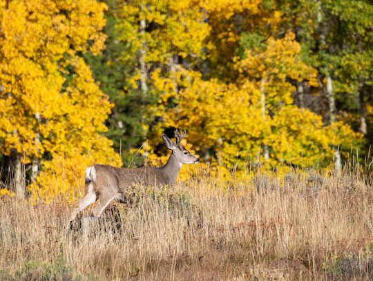
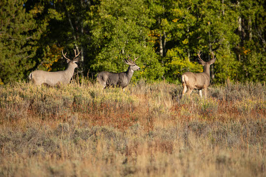
We hadn't even finished passing the lake yet when we noticed something else of interest. Three quality bucks were running along a ridge above us. Something off over the ridge had them concerned, but they stopped long enough for us to take a couple of pictures. Not the moose we were looking for, but still a treat!


Nice buck in State Forest State Park

Three bucks on a ridge in State Forest State Park


The deer were one of our last big game sightings of the day. We would see another moose not long after, but he was running full speed across the road in some fairly heavy brush, so we only got a quick glimpse before he had vanished. Still, the fall colors did not disappoint. A few more pictures, and then it was time to switch gears and go fix breakfast. 


The Road to Lake Agnes

After breakfast, it was time for our real adventure of the day. I had done some research and wanted to hike to at least one lake and possibly two. By the time we finished, however, the one hike would end up being plenty. We debated trying to do the hike all the way from camp, but a much closer starting point appealed since it would greatly shorten the hike and leave us the option of more hikes, or so we thought. 

Driving up the dirt road towards Lake Agnes, things were supposed to be rough. They have all the usual signs about recommending 4 wheel drive and high clearance. I learned a long time ago that those signs are often not really accurate, and figured this time would be the same. We poked slowly up the hill in my wife's little Corolla, dodging a few larger tire popper rocks but generally making good headway. 

The problem came when we approached a sharp curve that switch backed up the hill. There were lots of ruts and plenty of deep soft dirt. In other words, we were in trouble. I got out to look things over, knowing that I still had the option of turning around before I got us stuck. Upon closer inspection, I could see a vague line that just might work. I've done these crazy (stupid?!?!) things a few times over the years and found that generally you could make it through in a sedan. 

I'll pause to say right now that we should have videoed this whole thing. The line that might work without completely burying the car was low on the downhill outside edge of the curve. I got a good start but quickly bogged down since we were trying to make the turn. Then things went from bad to worse. Every time I backed up a little and tried again, we slid downhill a little more. 

Before things were over, the back end of the car was in a good sized evergreen tree on the side of the road with the toddler screaming her delight. She thought it was the most hilarious event of the whole trip. My wife wasn't as amused. The poor car put up a valiant fight, but seemed to be in danger of losing this round. Since I didn't have any shovels or other tools, it was going to be a pain in the rear to dig it out and retreat down the hill. Finally, after a silent prayer and another try, we were somehow on our way, skidding and spinning our tires up and around the curve. It was a true miracle, but I'll definitely take it. 

After the bad curve, things were anticlimactic. As I expected, the road was fine as long as you paid attention. If it wasn't for that one curve, this road would definitely be fine for 2 wheel drive sedans if the drivers know how to negotiate rougher roads. In the back of my mind, I had the nagging thought that we still needed to get back down the hill, but for the time being, I was just glad to be hiking up to Lake Agnes.

Hiking and Tenkara Fishing at Lake Agnes

This hike is a short one at under a mile from the parking lot to the lake. Once you add in the loop around the lake, it is still probably under 2.5 miles. We assumed that since it was such a short hike and we had just had breakfast, that we wouldn't need to take a lunch. That was a mistake! We enjoyed our time so much that we could easily have spent the rest of the day up there. In the end, we felt rushed because it was important to get back to our vehicle for lunch for the little one (and ourselves!). 

Lake Agnes itself is absolutely gorgeous. The towering Nokhu Crags along with Mt. Mahler and Mt. Richthoven surround this beautiful basin. We kept stopping and taking pictures, although as always seems to be the case, pictures simply do not do this place justice. The time of day wasn't great for pictures either with bright sunlight. Still, we had to have some memories.

Lake Agnes and Nokhu Crags in State Forest State Park

Island in Lake Agnes below the Nokhu Crags


Wildlife abounds. One of our favorites is the pika, and we constantly heard their calls on the surrounding slopes. My wife snuck off to try and capture some pictures of them while I poked around with the tenkara rod. Little bit was riding on my back, mostly happily, although we also let her down in a couple of spots to burn some energy. Here are a couple of the better pika pictures. 


Pika at Lake Agnes in State Forest State Park Colorado

Pika at Lake Agnes


While Leah was photographing wildlife, I was plying the waters of Lake Agnes using my Tenkara USA Rhodo and what was quickly becoming my preferred high country lake rig: a parachute Adams on top and a pheasant tail nymph on the bottom. Fish were cruising, often just out of casting range. This is the downside of fishing Tenkara on bigger water. Still, I eventually found some in close enough to shore on the south end of the lake. 


Hooked up on Lake Agnes

Gorgeous cutthroat trout at Lake Agnes in State Forest State Park


We continued our circuit of the lake, but time was running out. We were all getting hungry, but this was especially true of the toddler. It was time to head back down the hill to our car and try to negotiate that horrendous curve back down to camp. After one or two last pictures, we quickly descended to the trailhead. The drive back down was anticlimactic. My concerns were groundless. With gravity behind us instead of against us, the curve was a piece of cake and we were soon back at camp having lunch. 

Afternoon Drive Through State Forest State Park

Our morning adventures concluded rather late, so after lunch, we needed to find a way to get a nap in for the little one. The hike had been too interesting for her to get a good nap in, so we decided on the old trick of going for a drive. It always works for her although sometimes better than other times. On this day, she was tired and knocked out quickly. We drove back to some of the same scenes from the morning. The fall colors were beautiful although not as nice as they would be another week or two after our visit. 

Medicine Bow Mountains at State Forest State Park

Golden Aspen in State Forest State Park


The day got away from us rather quickly. After our drive, we got water from Ranger Lakes Campground, had supper, and headed back to camp for our last night in this beautiful place. While the water situation was frustrating, we'll definitely be back to this area. I wouldn't mind doing some overnight backpacking into some other high country lakes someday as well. The sunset that evening gave us one last gift before out time at State Forest State Park ran out. 

Sunset in State Forest State Park from the Crags Campground


Thursday, July 20, 2023

Colorado 2022 Day 7: Moving to State Forest State Park

Our time in Rocky Mountain National Park had finally come to an end. We had enjoyed our time there and had some of the best hikes of our whole trip. We still had two excellent hikes, one shorter and one longer, but we were headed towards more fishing (or so we thought) on the rest of the trip. 

State Forest State Park was our next destination. Part of our goal on this trip was to enjoy the autumn colors, and from past experience I knew that it offered some incredible potential. The only downside is that we were visiting a bit earlier than my previous experience. Still, we hoped that would mean nice weather and a good time out camping.

After packing up everything at Timber Creek Campground, we headed out on a long circuitous route that would see us just a few miles from where we started, but on the other side of the mountain. Such is life out west. The trip went by uneventfully. We had a quick picnic lunch at a roadside picnic table and grabbed some groceries, but otherwise were anxious to get to our next destination.

As we got close to our campground, we started to find some cause for worry. A sign on the road in warned that the water was out in our campground. We had reservations to stay at the Crags Campground. I was hoping to hike to at least one more high elevation lake on this trip, and that campground was close to the hikes I wanted to do. I was NOT impressed with the fact that the Colorado Parks and Wildlife had not informed us about the water being out. With a toddler along it proved to be a real pain, but something we figured we could manage for the two nights of our reservation. I almost simply moved to an unoccupied site at another campground, but in the end we decided to just go with it. Of course the Park office was already closed, so we couldn't really do anything but figure it out for ourselves. 

Needless to say, I don't recommend staying at CPW campgrounds if it can be avoided. On the other hand, I will also say the campground at Elevenmile State Park that I've stayed at before was very nice and we had no problems. So, your mileage may vary. I was mainly just really aggravated that we were already working hard to take a toddler camping, then they made it harder and didn't bother telling us.

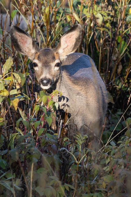
Our evening drew to a close with a beautiful sunset that lit up the mountain behind us with a warm glow. Best of all, we discovered that we had camp deer! Our little one loved every minute that the camp deer were wandering through snacking on the greenery around us and that made it all worth the trouble. The next day was going to come before we knew it, so after a quick supper, we went to bed. As we drifted off, we heard large creatures walking around chomping, presumably our camp deer or moose, but we were too tired to investigate...

Mule Deer at The Crags in State Forest State Park


Monday, May 29, 2023

Colorado 2022 Day 6: Hiking and Fly Fishing Timber Lake in Rocky Mountain National Park

This was another of our favorite days on this trip. Our original hiking plans had been put on hold, mostly because I had forgotten entirely about the East Troublesome Fire. This massive inferno had roasted large swaths of the west side of Rocky Mountain National Park in 2020. North Inlet Trail had been severely impacted by this fire, meaning large sections of the trail would be out in the hot sun instead of winding through the shaded forest. I still hope to eventually hike some or all of this trail, but for our purposes on this trip, we looked for other alternatives.

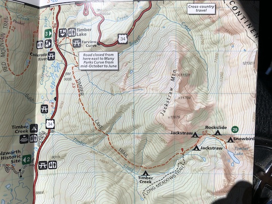
Timber Lake is one of the most easily accessible high lakes on the west side of Rocky Mountain National Park. When I saw most easily accessible, all I'm saying is that some of the lakes on this side involve hiking 10-15 or more miles one way. This is still a relatively strenuous hike, with over 2000 feet of vertical gain AND a little over 5 miles of hiking one way. Our National Geographic Trails Illustrated map suggested that the trail slowly contoured up the steeper terrain. However, once we got there, it turns out there were some intense switchbacks. It is fairly rare in my experience for these maps to be off, but this time it seemed to not be the most accurate portrayal of actual conditions. Still, even with the intensity, this was an excellent hike and one we'll probably do again someday. Oh, and the fishing was pretty good...

Hiking to Timber Lake: The First Half

The hike to Timber Lake in Rocky Mountain National Park starts at a trailhead in the northern part of Kawuneeche Valley, shortly before the road starts switchbacking up the side of the mountain on its way to the top. Just across the road is the trailhead for the Colorado River trail. The trailhead is around 9,000 feet in elevation, so we had a touch over 2,000 vertical feet and a little more than 5 miles between us and our destination. However, much of the elevation gain happens in bursts. The first half mile or so was gently rolling through a beautiful mix of evergreens and aspen which were beginning to turn gold. From looking at the trail map, we knew this wouldn't last long. 

Map of Trail to Timber Lake in Rocky Mountain National Park


Sure enough, the trail began climbing in earnest as it angled up the mountain. With a toddler strapped onto my back via the kid carrier, the trail seemed harder than it probably was. I probably had somewhere around 25-30 pounds on my back. In addition to the baby and her things, I had water, a water filter, fishing equipment (Tenkara USA Rhodo rod), and of course some camera gear, a good solid load any day.

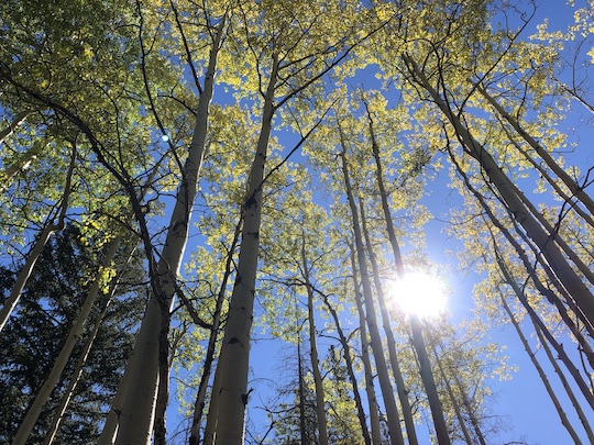
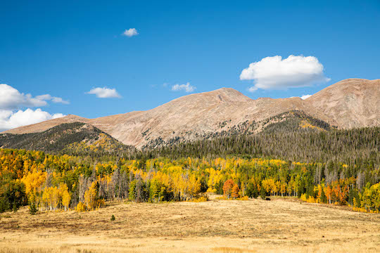
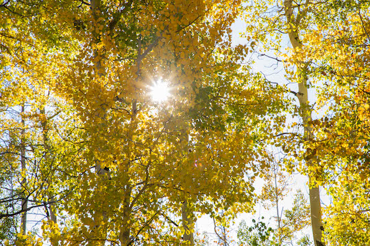
While not quite at peak for the most part, there were just enough golden aspen to make us reach for the phones for a quick picture from time to time. Our trip had been timed with the hope of seeing some good fall colors while not experiencing too much extreme cold. That is a fine line and one that is easy to mess up. On this trip, we mostly succeeded the first half or so of our time there.

Golden aspen along the trail to Timber Lake in Rocky Mountain National Park

View of aspen on trail to Timber Lake


At the trailhead, we had noticed a sign warning us of a landslide. The rangers at the Kawuneeche Valley Ranger station had also warned us of the landslide. We figured it was no big deal, but were also intrigued. When we finally discovered it approximately 2.5 miles in, we realized it really was quite a landslide! The slide was a decent obstacle on the trail. While something like this wasn't normally worth mentioning, I will say that it was slightly more challenging with a toddler in a pack on my back. The main difficulty came in having to duck/crawl under huge logs (or crawl over them). I had to be extra cautious not to hurt the little one. Otherwise it wasn't a big deal. 

Hiking to Timber Lake: The Second Half

If the first half had been relatively easy, the second half was much more challenging. The trail itself was still easy to negotiate, but was also much steeper than we had surmised based on a glance at our National Geographic Trails Illustrated map. The trail looks like a straight run angling up the hillside, but we discovered there were some rather intense switchbacks made all the more intense by the 25-30 pounds on my back. We were starting to get hungry, and lunch seemed like a good choice part way up one of the switchback sections. 

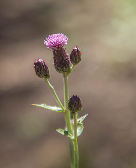
While we were stopped, I decided to dig out the camera. Some thistle growing nearby was perfectly illuminated with a nice dark background. I didn't play with the camera long because I was hungry, but I was happy with the pictures I managed to get. 

Thistle on the trail to Timber Lake in Rocky Mountain National Park


After eating, we were rejuvenated for the final push to the top, or at least the top of our hike for the day. Timber Lake is in a beautiful high basin surrounded by towering cliffs. On our way up, we passed through numerous small meadows, each time looking carefully for elk or moose. We weren't destined to find any on this hike, but the bright sunny hours of midday were probably not ideal for seeing these critters.

Open meadow view on the trail to Timber Lake in Rocky Mountain National Park


Leah did spend a fair amount of time searching out some pika. These are one of our favorites, and she really wanted to get a good picture. While I plodded on up the hill, slowly putting one foot in front of the other on the last push to Timber Lake, she chased these little rodents with her camera. She got a few, but alas none of the pika would allow her to get close enough for a very clear shot. These things are hard to sneak up on!

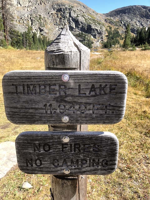
As we broke out of the woods and into the basin with the lake in front of us, a sign informed us that we were now indeed over 11,000 feet. My lowland lung capacity had already suggested that to me, but the gorgeous lake in front of us made up for any small inconvenience or suffering experienced along the way. 

Timber Lake sign and elevation information


Fishing Timber Lake in Rocky Mountain National Park

Of course, since I had hauled my fishing equipment up, I was definitely intent on at least getting a fly wet. When I walked along the banks and saw fish cruising just off shore, I knew that the chances of catching a fish were pretty high. I still had everything rigged from our hike to Sky Pond. That meant a parachute Adams which always seems to be a good choice on these high elevation lakes. 

Rocky Mountain National Park Timber Lake panorama


Before getting serious about the fishing, I did take some time with the camera. Timber Lake is incredibly beautiful, made even better by the lack of crowds compared to high elevation lakes on the east side of Rocky Mountain National Park. While we did see another group or two, it felt relatively deserted after our hike to Sky Pond. 

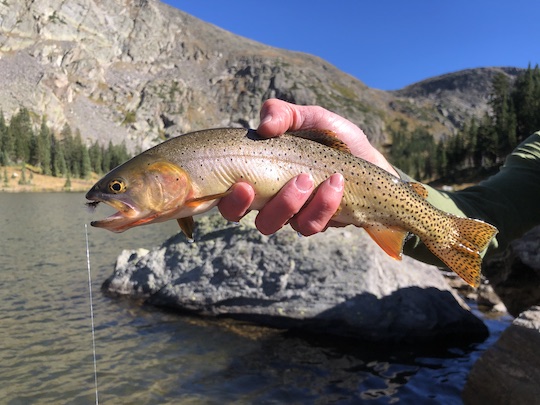
Pictures completed, I began to hurry as the urge to fish grew. The toddler with me was interested in throwing rocks in the lake, so we made sure to do that a little in between our preparations to fish and even in between casts. The casting was exciting enough that we both participated in that activity as well. Eventually, one of the native residents graced the end of our line and we enjoyed our first Timber Lake cutthroat trout. 
Colorado River cutthroat in Timber Lake in Rocky Mountain National Park


We managed a few of the beautiful cutthroat before getting anxious to start back. With a little one to get ready in addition to ourselves, we have found our hikes to start later than in the past. Thus, we are usually pushing our time late in the day. With 5 or so miles to get back and the sun already dropping in the western sky, we knew it was time to say farewell to Timber Lake until next time. 

Hiking Back From Timber Lake 

I hung back a little and snapped a picture as Leah started down the trail. Then it was time to start hustling to catch up. We still had some adventures to enjoy on the way back out. 
Hiking the Trail to Timber Lake


Back down the trail, in the vicinity of the landslide, I had noticed wild raspberries growing in several spots. While we didn't want to gather any for later, it was a welcome treat for our little one. She had already discovered these on a previous hike and had even found a couple at camp. We were having to keep an eye on her since she had discovered where the raspberries came from. We couldn't risk having her eat every brightly colored berry she found, but when we did find actual raspberries, she was having a ball. I might have sampled one or two, but most that we found went to little bit. It was worth finding them just to see her enjoy them!

The shadows were getting longer and longer and the hues of fall around us reminded us how cold it would get once the sun set. It was time to get back to camp.
Fall color along the Timber Lake trail

 
We got back as the shadows of the surrounding mountains deepened over the valley. With just enough time for a quick supper, we hurried with our evening routine and then hit the sack. All of us were tired, but the pack mule (ME!) was probably the most tired. It had been a great day. Even as tired as I was, I had one more goal. 

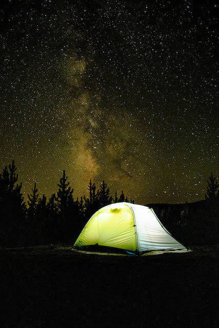
Star Gazing at Timber Creek Campground


Star Gazing at Timber Creek Campground was one of the things I remembered most from my past trips to this campground. While a lot had changed since my last visit, the incredible night sky was still just as good as I remembered. We hoped for some other good night sky views on our trip, but little did we know that our clear starry nights were numbered. In the meantime, I had a good time with my camera. This Big Agnes Manzanares tent, like all of my others, has served me well through many amazing adventures. If you're looking for a tent, I recommend checking them out!

Night sky and Big Agnes tent at Timber Creek Campground


Sunday, April 23, 2023

Fly Box Winner

Our latest fly box winner is.....Charlie Barton!!! Congrats Charlie and I hope you enjoy your new fly box. 

If you didn't win this time, please keep an eye on this blog. We'll be doing another giveaway again sometime soon. Thanks to everyone who entered!